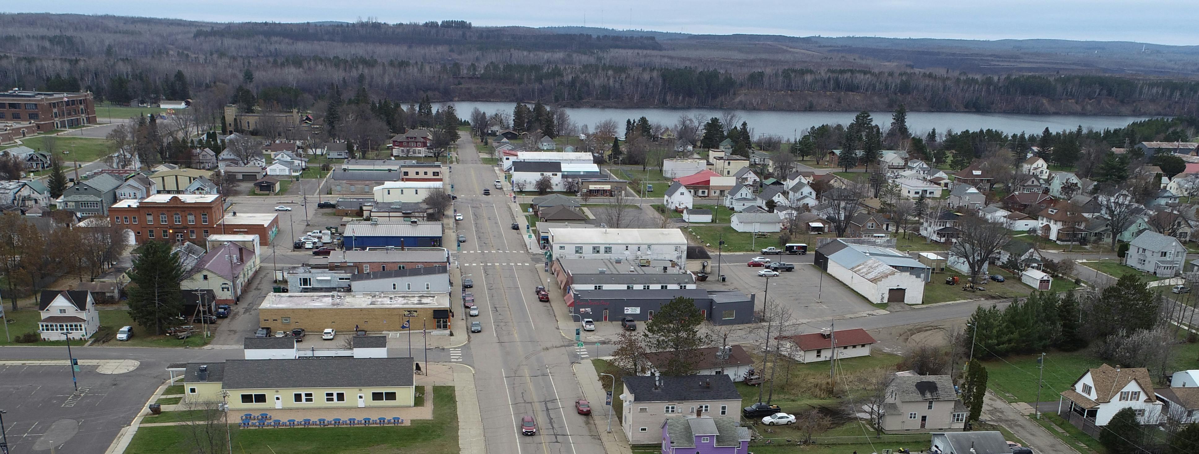
CSAH 100 Corridor
St. Louis County is leading a corridor study of CSAH 100 (3rd Ave N/Main St), beginning at a point 0.22 mile east of MNTH 135 and ending at CSAH 110 (Hwy 110), for a total length of 1.83 miles in the City of Aurora. Part of this study is proposing construction of one grade separated bridge at CSAH 100 railroad crossing in Aurora, MN which would eliminate the railroad crossing. The County is applying for a grant for this. Check out the website here: CSAH 100 Railroad Crossing Elimination Grant | Input Central. The outcome of this study will be the preferred corridor layout which will be used for the planned reconstruction project on this corridor in 2026. This study is anticipated to be completed by this December 2024.
The key focus areas of the corridor study include…
- Complete an intersection control evaluation (ICE) of Main St and 3rd Ave N. The ICE will recommend a long-term intersection control strategy.
- Develop a typical section(s) for the CSAH 100 corridor.
- Develop a 2D (aerial view) layout for the CSAH 100 corridor.

Preliminary Layout Recommended by Corridor Study
To see a larger version, Click Here


Railroad Bridge Overview
St. Louis County is proposing construction of one grade separated bridge at CSAH 100 railroad crossing in Aurora, MN. The proposed bridge crossing addresses the critical need to ensure connectivity and mobility for the regional transportation network, particularly freight and EMS traffic, in the event of a blockage or closure. Depending on the route, the detour length ranges from 19 to 29 miles. The proposed bridge crossing also responds to existing and projected needs by providing reliable and safe connections for freight, logging, pedestrians, bicycle and recreational vehicle traffic. The Project would create a reliable and sustainable regional transportation network, which is essential for the local economy and the mining and logging industries of the eastern Iron Range.
For more information click here.


Get Involved
Share your insights, experiences, and questions as we look to develop a community-supported vision before we develop a project.
- Attend public meetings (in-person or virtually)
- Complete the online survey (CLOSED)
- Complete the online comment map (CLOSED)
Stay Informed
- Sign up for email updates
St. Louis County Contacts
-
Phone 218-625-3873 Email lundv@stlouiscountymn.gov -
Phone 218-742-9821 Email fallstrome@stlouiscountymn.gov
